River Runner
Designing a purpose built app for finding and floating rivers
Plenty of apps exist to help adventurers find their next trail and plan their next trip. But nothing currently exists with the features needed to find rivers and plan river trips. Finding and navigating rivers requires a special set of information and tools not currently available all in one place in the market.
Problem
Planning a river trip can be daunting. From searching for the river, finding river level information for safe floating conditions, to navigating the river; there is a lot to plan. Currently, there are no apps on the market that handle all of the needs of users wanting to plan river trips. Users are left to pull information from many different sources to compile a plan to navigate the river.
Solution
A purpose built app for floating rivers. Based on my research, it was apparent there is a need in the floating community for a purpose built app that handles the complexity of floating rivers and planning river trips. Existing outdoor mapping solutions are focused on land based actives and lack the toolset needed to provide floaters with all the information they need in one place.
Year Completed
2023
Role
UX designer responsible for all research, branding, visual design, prototyping, and testing
Tools Used
Figma, Notion, Illustrator, Google Forms, Zoom, Concepts & Mockups Apps (iPad), Mapbox
Methodologies Used
User Survey, User Interviews, User Persona, Competitive Analysis, Venn Diagram, Secondary Research, User Flows, Sketching, Feature roadmap, High Fidelity Prototypes, Usability Testing

Meet Jake
Jake and his family are weekend warriors that like to spend as much time as they can in the outdoors. Recently, they've gotten interested in adding floating rivers to their list of family activities. Jake usually plans the details of their trips but is having a hard time find a good source of information about rivers that includes all the needed information to plan river trips with his family.
“My weekend warrior family and I have just gotten into kayaking. We really love it and want to find new rivers we can float near us and even in other states.”
Research
Secondary Research & Competitive Analysis
I scoured internet forums about kayaking and analyzed several direct and secondary competitor apps to get a good idea of what currently exists in the market.
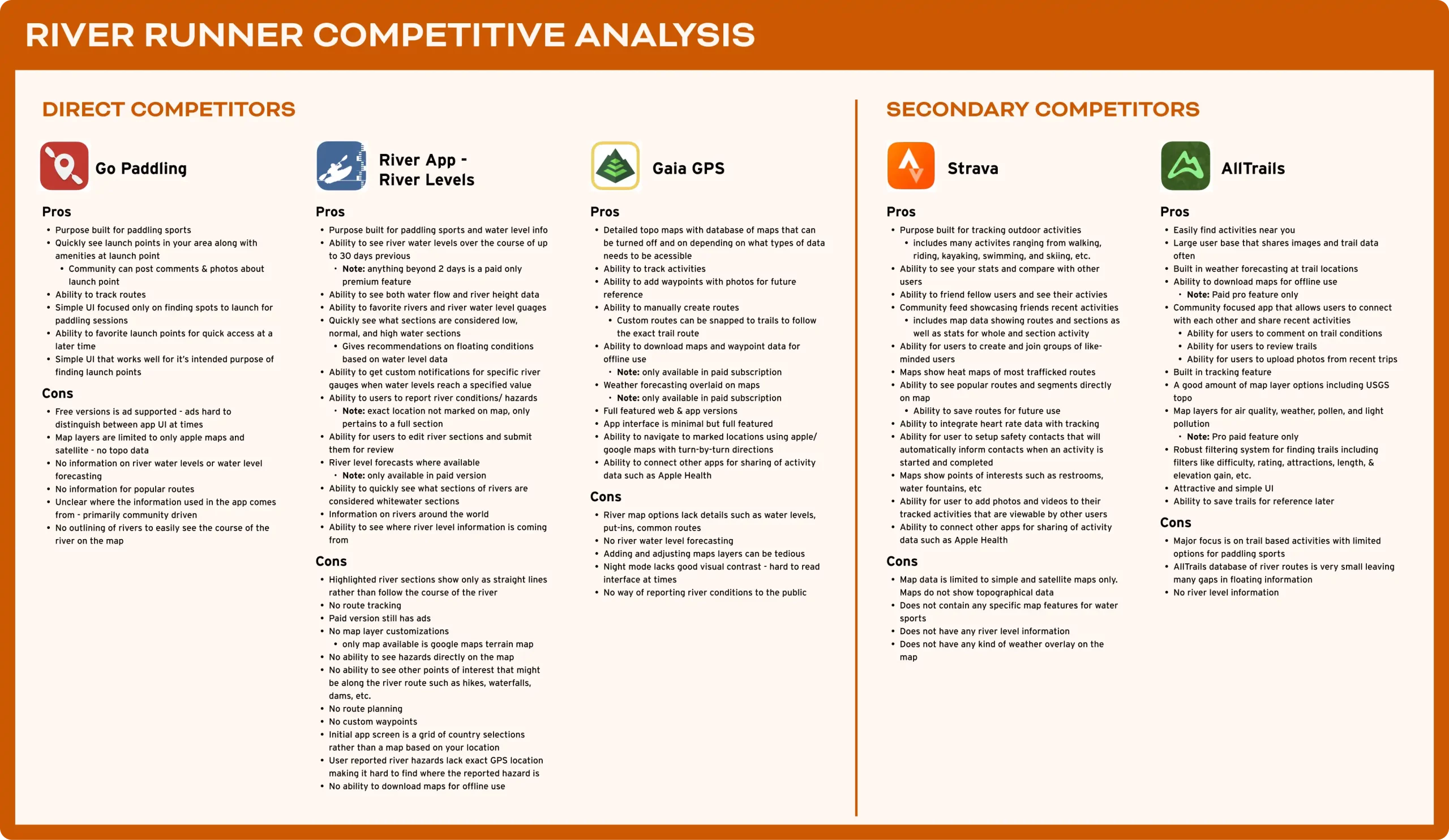
Key Takeaways
One
Of the many options available to find information for paddle sports, none exist that provide an all in one app for planning, tracking, and sharing trips.
Two
Solutions that currently exist for floaters require the use of several apps and websites to gather the required information to plan trips.
Three
Some features that are not present in current floating specific apps are: manual waypoint creation, detailed reporting on specific problem areas along river routes, ability for floaters to find nearby points of interest such as waterfalls, dams, viewpoints, hiking trails, etc, downloading of river maps for offline use, detailed weather forecasting, and more.
User Survey
A user survey was done to gain general demographic data about the river running community as well as some insights into how users currently go about planning their float trips. Survey results would go on to help me determine my questions used in my user interviews.
User Interviews
Interviewees were sourced through my survey and varied in age, river experience, and location. Interview questions aimed to understand how floaters find, plan, and navigate river trips, as well as identify frustrations with their current methods.
Needs
100%
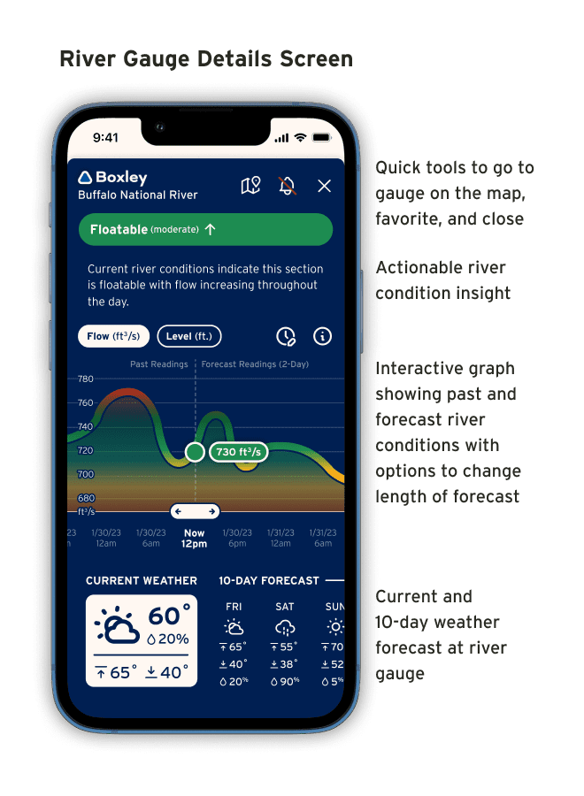
look at river level/flow in order to determine if the river is floatable
reported that the put-in/take-out information is one of the most important pieces of information they use in planning trips
indicated that they talk to local floaters to gain intel about river conditions and problem sections
indicated they look at weather forecasts to aid in planning
indicated they use physical maps and guidebooks to aid in navigation
indicated that they camp overnight sometimes when floating
60%
indicated the use some kind of device or app to track their floats
indicated they like to stop at points of interest while they float
Frustrations
60%
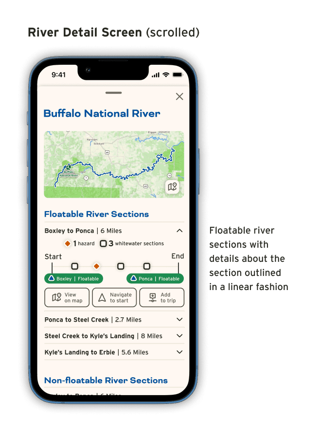
Reported frustrations with finding accurate river distances.
40% of those reported it being difficult to use apps because the distance had to be calculated by manually making waypoints along the river
20% use physical maps which can be tedious
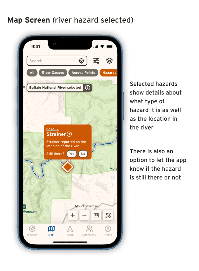
Reported it’s difficult to find information about river hazards
river hazards could be strainers (trees in the river you can get caught on), low-head dams that can be dangerous, waterfalls along river, maytags (whirlpool type areas in the river)
Reported it’s difficult to know what areas around the river are publicly accessible
This information mainly aids in emergency situations and in times when they want to explore locations near the river
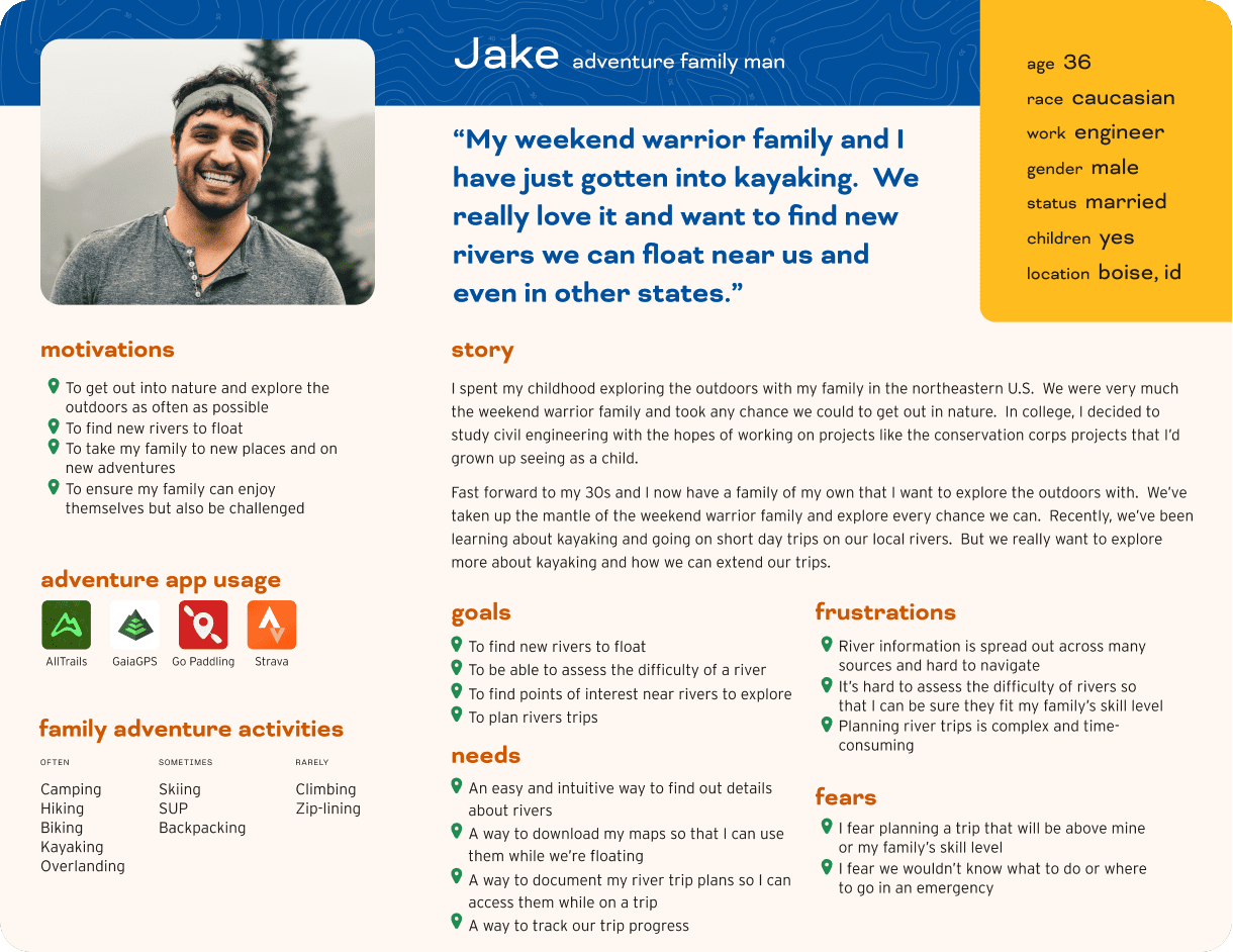
User Persona
With the development of this persona I wanted to express the the most common user needs and frustrations to help me empathize with my users throughout the design process.
Problem Statement
Planning a river trip can be daunting.
From searching for the river, finding river level information for safe floating conditions, to navigating the river; there is a lot to plan. Currently, there are no apps on the market that handle all of the needs of users wanting to plan river trips. Users are left to pull information from many different sources to compile a plan to navigate the river.
Designing Solutions
Solution
A purpose built app for floating rivers.
Based on my research, it was apparent there is a need in the floating community for a purpose built app that handles the complexity of floating rivers and planning river trips. Existing outdoor mapping solutions are focused on land based actives and lack the toolset needed to provide floaters with all the information they need in one place.
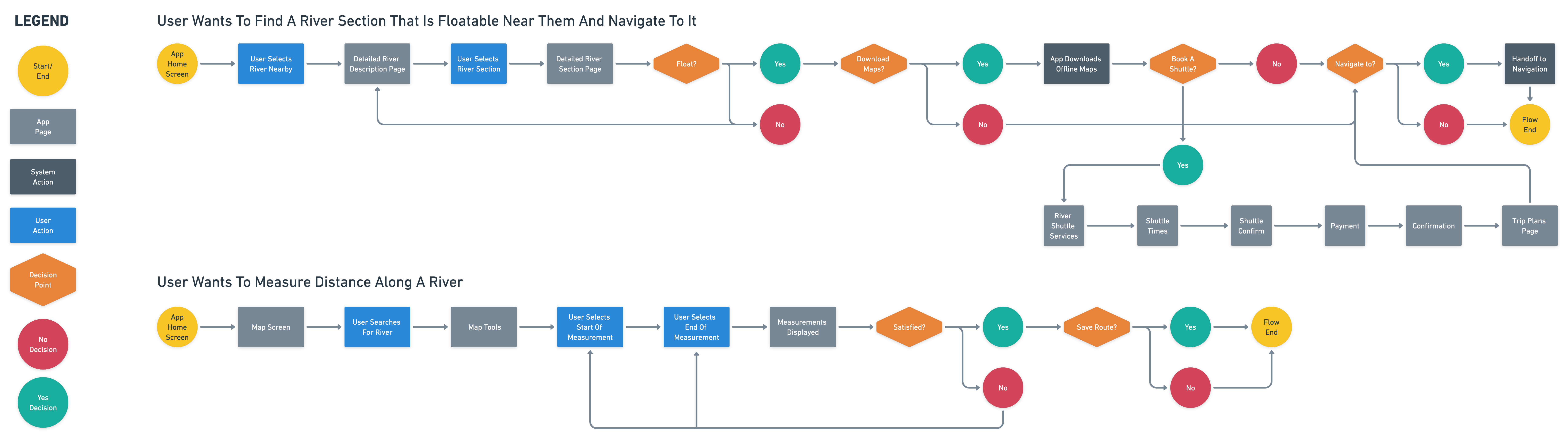
User Flows
I create several user flows for common tasks users might perform. My user flows gave me a better understanding of how the app could be structured to help users achieve their most common needs.
Sketching Solutions
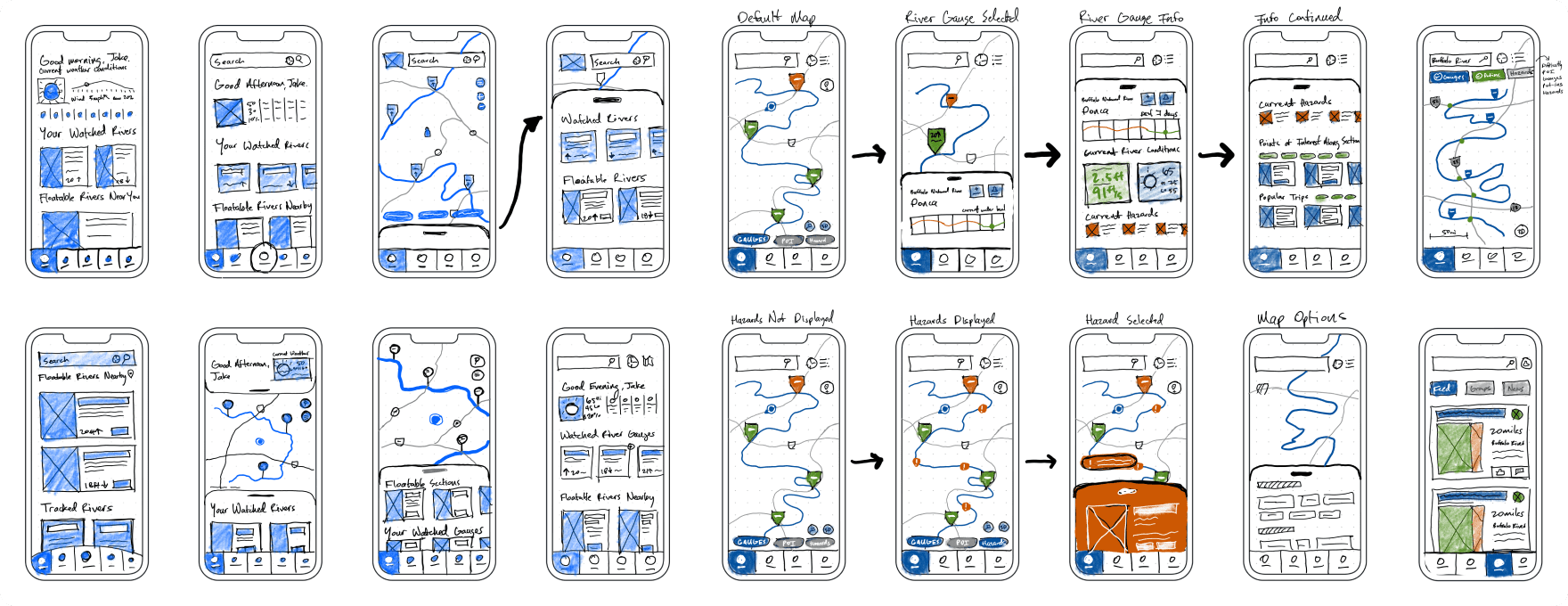
For my sketching on this project I used an iPad and Apple Pencil for the fist time which allowed me to quickly iterate while also using a bit of color and device frames to get a better idea of what might work before moving over to prototyping. I explored ways I could make the app simple to pick up but still provide features that power users might need.
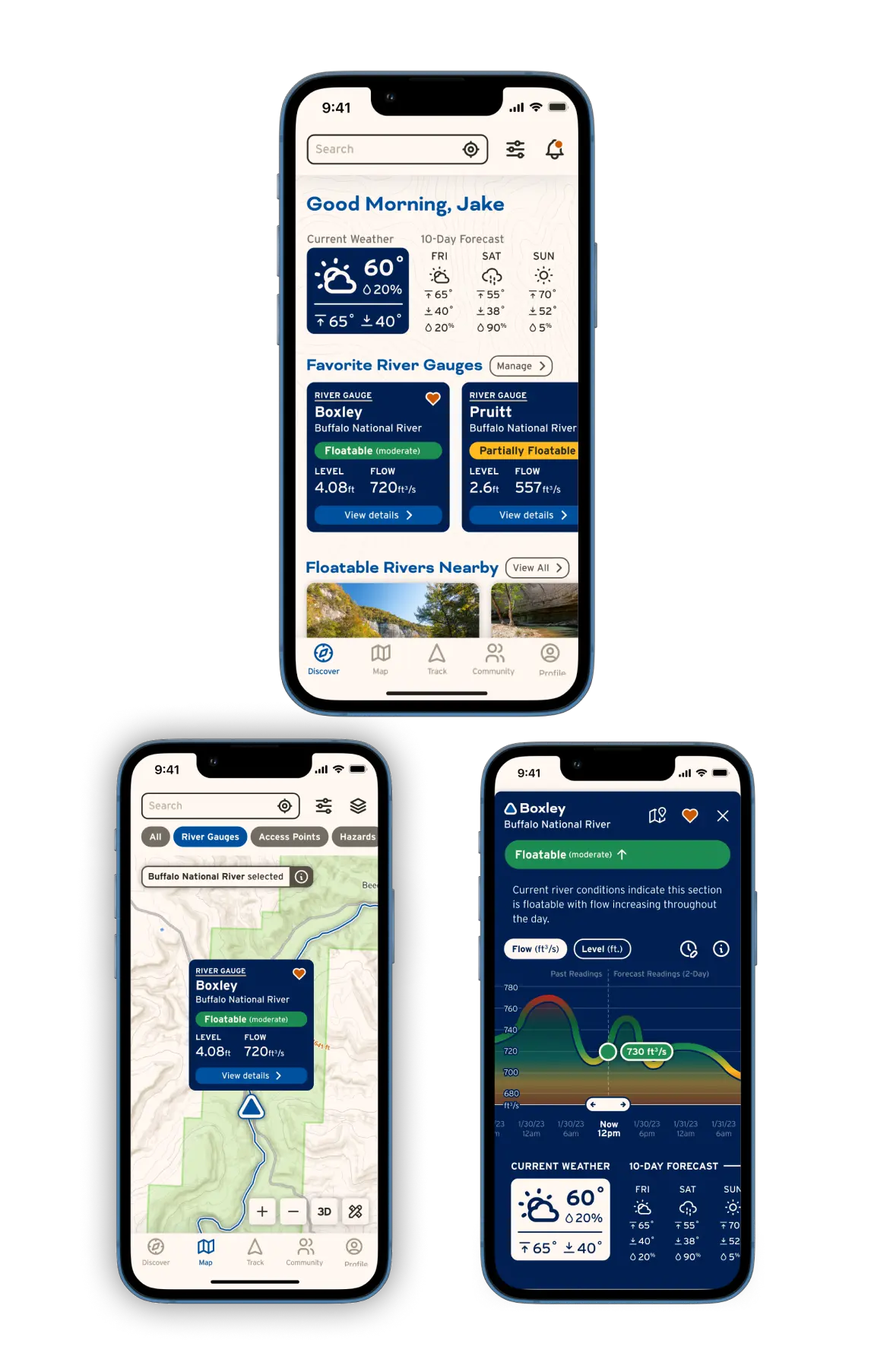
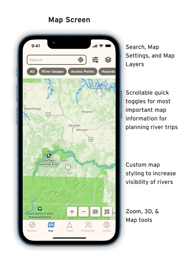
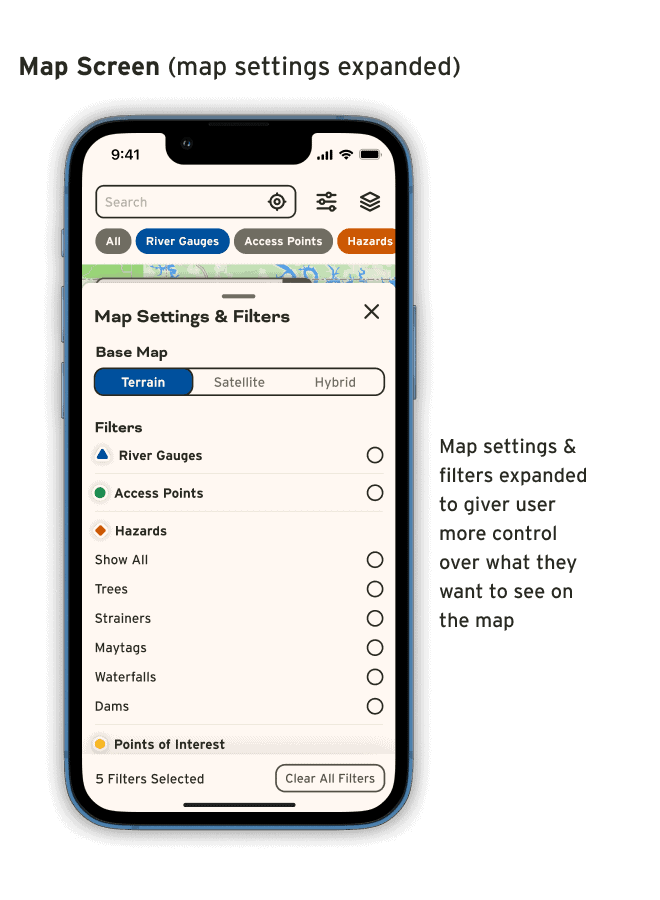
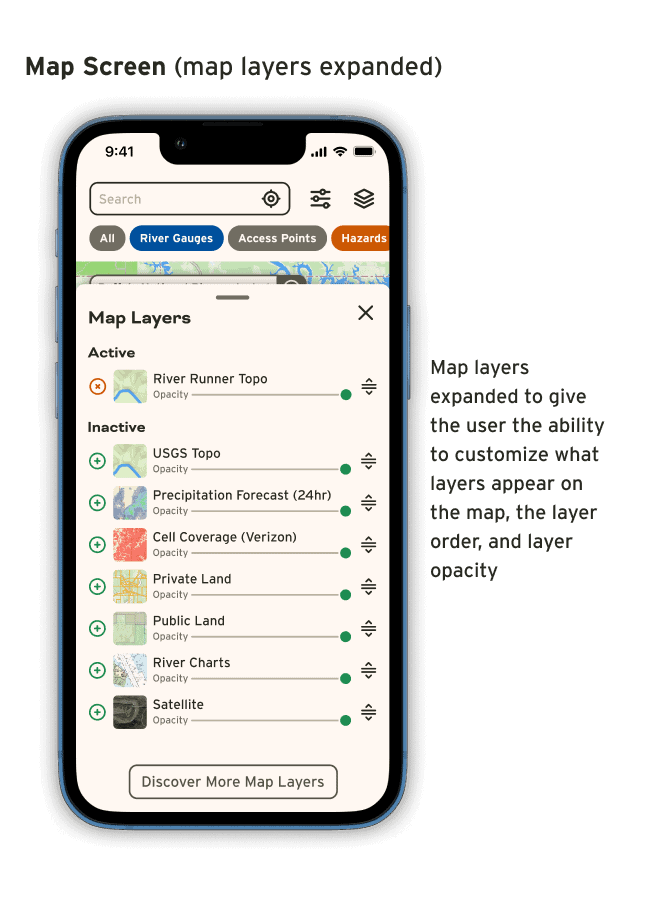
Custom Map Styling
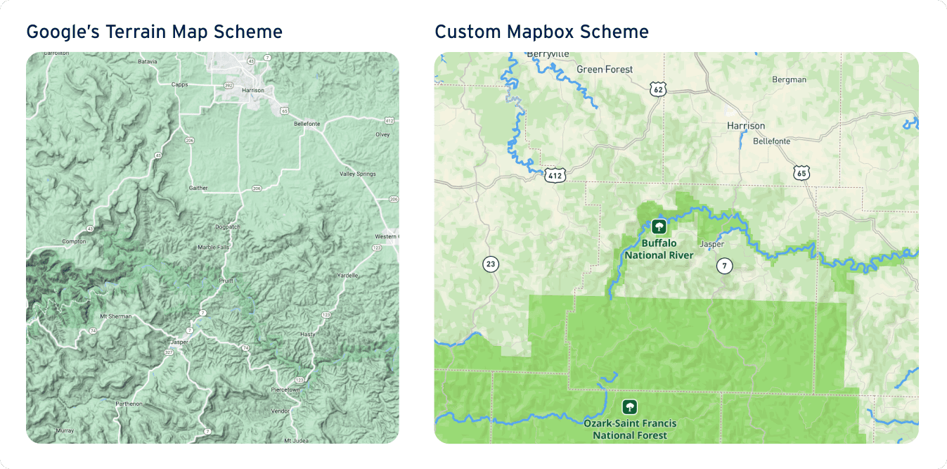
Many major mapping APIs prioritize roads over waterways making it difficult to find waterways on the map. Using Mapbox’s API, I created a custom map scheme that highlights waterways much more clearly and uses the brand colors.
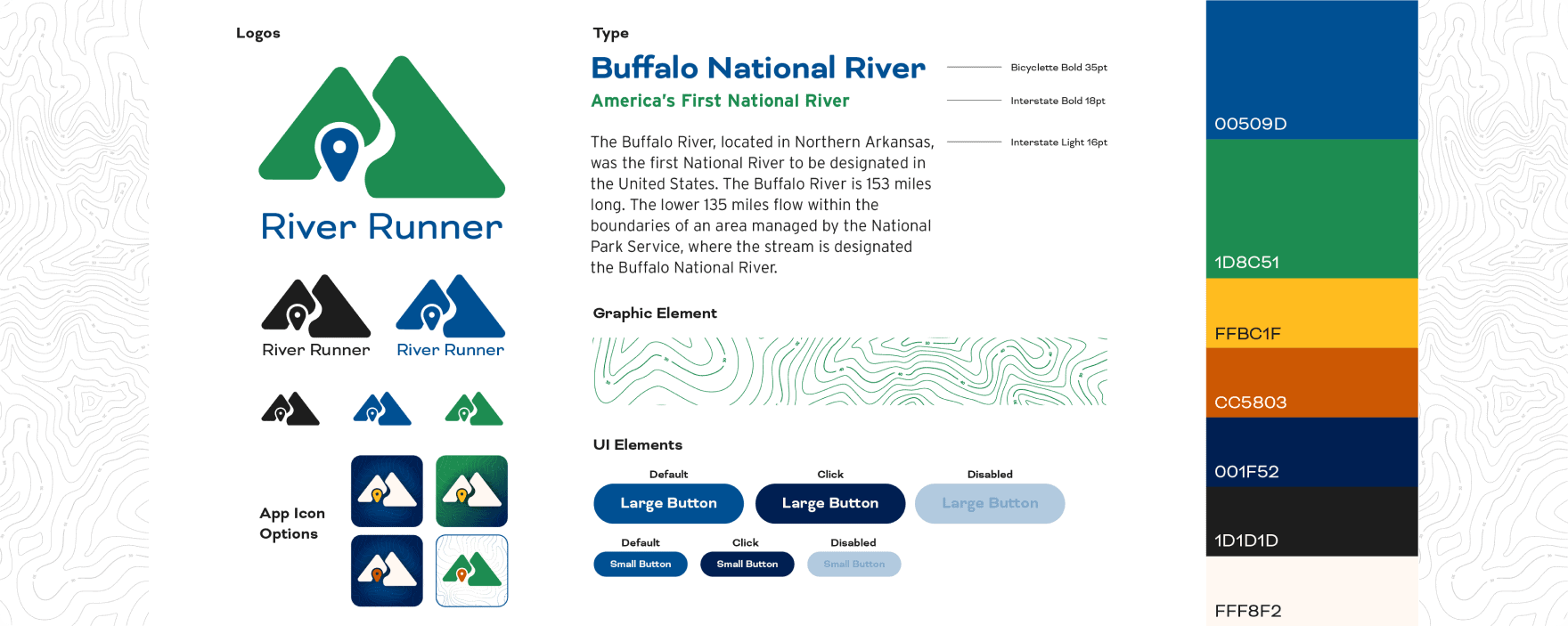
Branding
Building The Brand
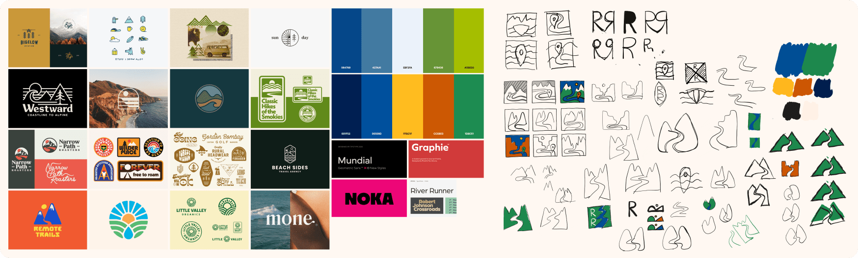
When designing a brand, I typically start with a feeling I want the branding to convey. In this case, I wanted the branding to feel friendly and natural. Next, I created a mood board with logos, color pallets, and typefaces that helped convey that feeling. Then I began sketching ideas and experimenting with colors and typefaces, eventually landing on a logo mark and branding style guide that I felt conveyed the feeling I was going for.
The Brand
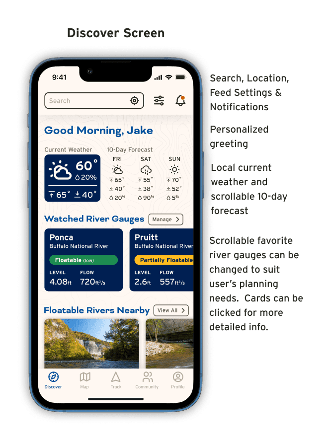
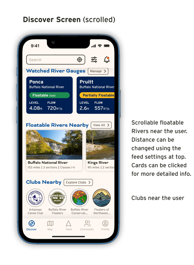
The Prototype
Testing
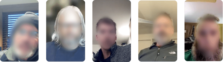
Usability Testing
Usability tests were performed with users with experience floating rivers and planning river trips. Tests were moderated over Zoom and involved 3 flows comprised of 5 total tasks.
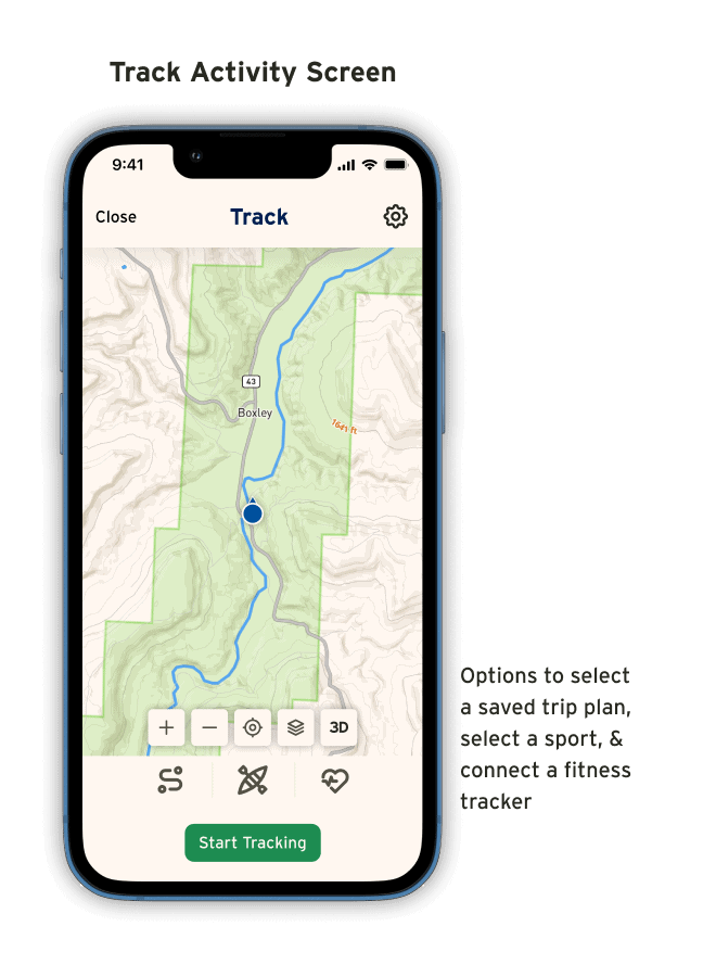
Flow 1
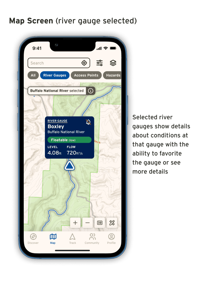
Task 1: Find the Boxley river gauge and add it to your watched river gauges.
Task 2: Find information about a hazard on the map.
Flow 2
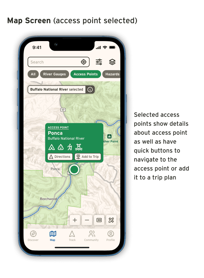
Task 1: Find the Ponca access point and navigate to it
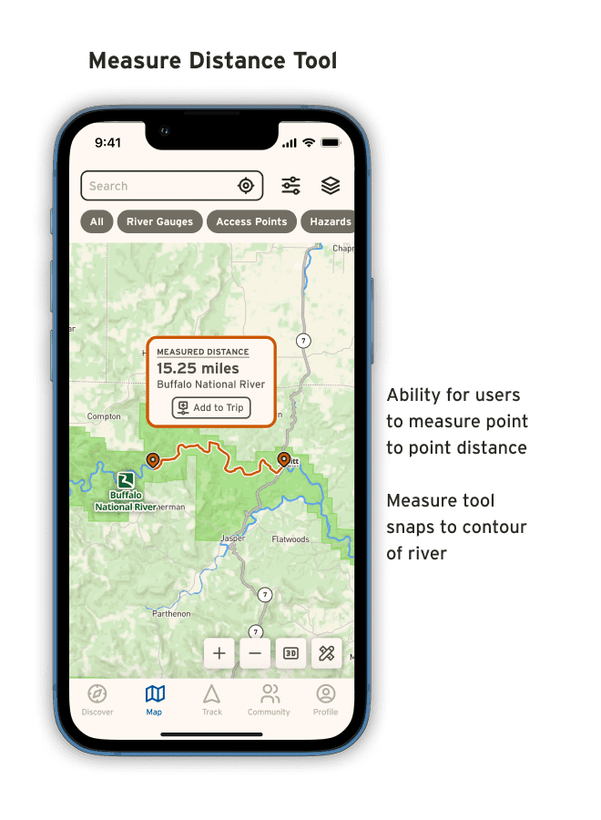
Task 2: Use the map tools to measure the distance along the river from one point to another.
Flow 3
Task 1: Tell me the forecast river flow at the Pruitt river gauge on January 31st at 12pm
Successes
100%
liked that the measure distance tool followed the river to get an accurate measure of distance without having to make multiple waypoints along the river
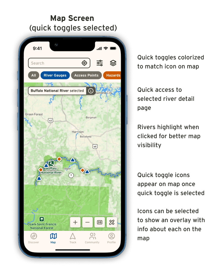
liked being able to quickly turn layers off and on on the map using the quick toggles
93%
of tasks were completed successfully without major issue
66%
felt like the app was easy to navigate and intuitive
Challenges
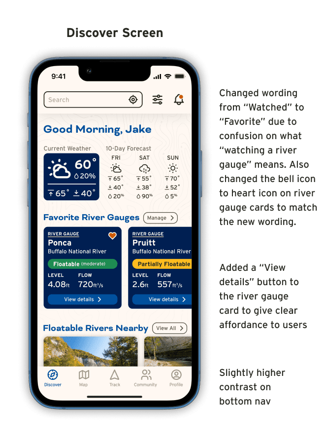
66%
had some confusion with the bottom nav not having enough contrast
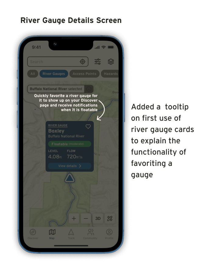
had confusion with trying to add a river gauge to their watched gauges
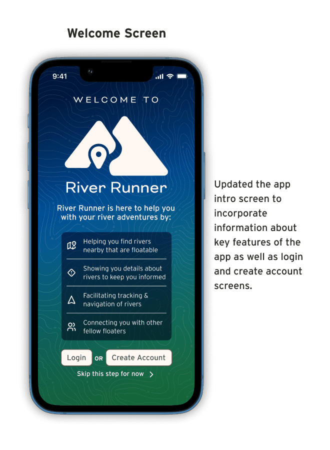
had some confusion on how to get into the app
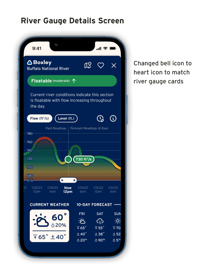
didn’t initially realize that the river gauge cards were clickable for more details
had some confusion about the 3D icon
33%
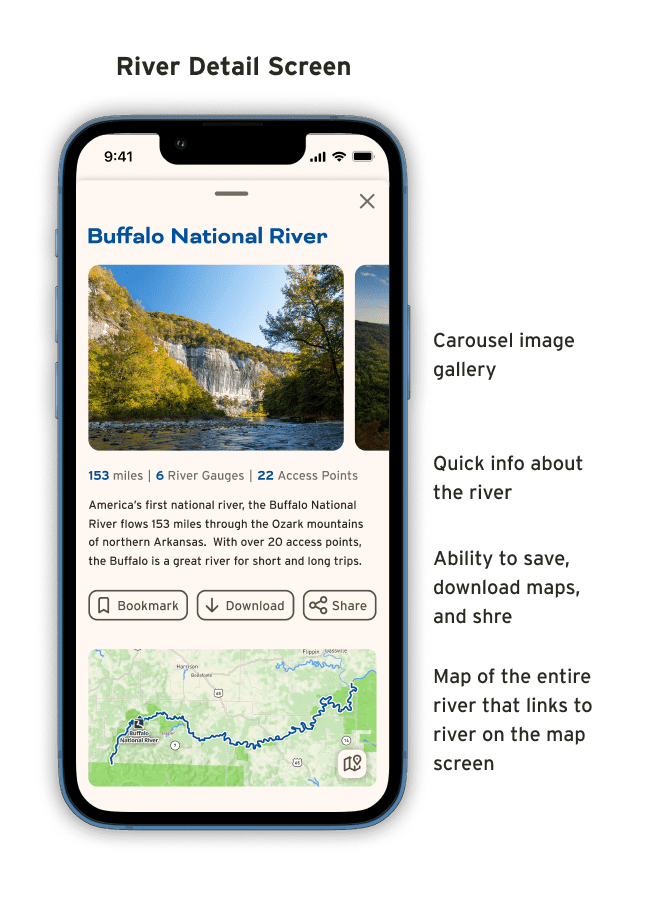
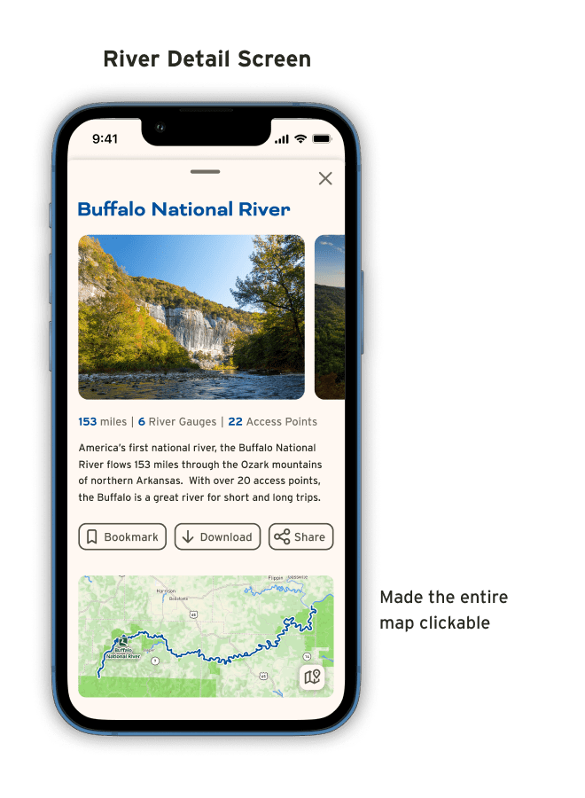
had some confusion on what to click to go from the river details page to the map view of the specific river
didn’t quite understand the idea of “watching” a river gauge
Revisions

Conclusion
Next Steps
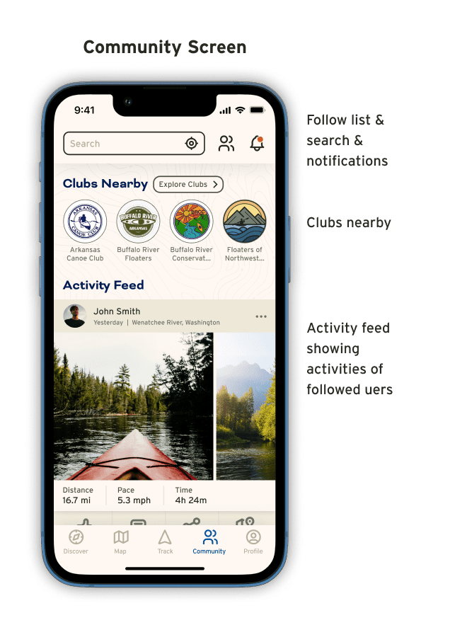
Exploration of more community features to enable users to add comments in all areas of the app to help facilitate dissemination of key information important to planning river trips.
Explore the addition of river outfitters to the app that can sell their services directly in the app and aid in the updating of key river information.
Prototyping of trip-planning features that enable user to plan complex multi-day trips, save them to their profile, and share them with friends.
Prototyping of shuttling features to aid users to planning complex river shuttles with groups of friends.
What I Learned
Don't judge an app by it's cover.
Mapping and navigation apps appear simple on the surface but are very complex and require a lot of foresight in their design as users will likely use many different paths to finding the information they are looking for.
What makes sense to me, might not to others.
Usability testing played an important role in my discovery that some of the elements of my design were not as clearly interactive or intuitive to their functionality as I initially thought.
Plan ahead.
Creating components as you go and using them for as many pieces of the design as possible greatly aids in your ability to make quick changes app-wide and make quick decisions on what works and what does not.